Table of Contents
Context
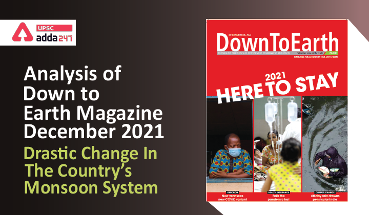
Though Jawad did not intensify into a “severe cyclonic storm”, its movement to the northern Bay of Bengal in December, when cooler sea surface temperature and wind conditions are unfavourable for sustaining cyclones, is as unusual as the weather
pattern prevailing over large parts of India since the monsoon season ended.
Key Observations
- An analysis of IMD data shows that between October 1 and December 7, as many as 17 states received “large excess” rains or 60 per cent more rainfall over the long-term average; and another 10 received “excess” or 20-59 per cent more rains than normal.
- Overall, the country has received 53 per cent more rainfall than normal. The pattern has been particularly stark in the country’s peninsular region.
- While the region experienced its wettest November since 1901, October too was among the wettest.
- Between October 1 and December 1, at least five districts—Coimbatore in Tamil Nadu, Pathanamthitta and Kottayam in Kerala and Dakshina Kannada and Mysuru in Karnataka—reported excess or large excess rains every week.
- While as many as 10 districts reported excess or large excess rainfall in the first four weeks of October 1-27, their number almost doubled after October 28.
Why untimely rains?
- The catastrophe unleashed during October and November defies logic as none of the two rain-bearing weather systems
was active during the period. - The southwest monsoon began withdrawing on October 6. Though it should have completely
withdrawn from the country by October 15, the process continued till October 26, during which the wind system remained
weak. - The delayed withdrawal of the southwest monsoon also pushed the entry of the northeast monsoon, which brings
rainfall over the southern peninsular region, towards the end of the month.
What Caused the Incessant Rainfall?
- Analysts link the sustained rains to the interplay of a few unique weather events at a time when the atmospheric temperature
was unusually high. - The entire northern hemisphere, including the oceans, has remained warm from January through October in 2021, with the only exception of the Siberian High.
- The Arctic sea-ice loss this year led to high sea-level pressure over western Europe and northeastern China, which
steered planetary waves southeastward instead of their eastward trajectory. - These waves, which produce circulation anomalies in the upper atmosphere, entered India late in the season and delayed the monsoon withdrawal.
- Then La Nina kicked in on October 14. This cooling phase of the El Nino Southern Oscillation (ENSO) phenomenon, during which the sea surface temperatures over the eastern and central Pacific Ocean remain cooler than average, affects the trade winds which carry this weather disturbance across the world.
- In India, La Nina generally triggers the formation of low-pressure areas, which contribute to increased rainfall. Thus, a moisture-laden atmosphere combined with La Nina conditions is likely to have created conducive conditions for the formation of more low-pressure areas, and rainfall events.
Big changes in the peninsular monsoon pattern
- A lot of changes in the monsoon conditions in peninsular India has been seen.
- Three decades ago, rainfall was spread through the northeast monsoon. Now we experience 25 cm of rain in one day, and 70-80 cm in one week. This pattern has happened thrice since 2005.
- The second change is a disruption in the hydrological cycle due to temperature rise because of climate change.
- Events that are not because of climate change include large floods and episodes of landslides in the peninsular states of Kerala, Karnataka and Tamil Nadu.
- These are mainly because of the declining area under forest. In the Western Ghats, we have lost around three-fourth of the dense forest.
- This loosens the soil and the velocity of the water increases unexpectedly. The water-withholding capacity of the soil decreases upstream and floods occur downstream.
Climate Change and Changing Monsoon Pattern
- The pattern of rains has changed drastically in Kerala since 2018. The rain calendar has been altered. The gap between the southwest monsoon and northeast monsoon is no longer there. Even a single high-intensity rain event can cause destruction anywhere in the state.
- As in the case of Western Ghats, the weather pattern on the Kerala coast has also changed in recent years. In the past, the sea surface temperature of the Arabian Sea was lower by about 1.5-2 per cent than that of the Bay of
Bengal. - As a result, there were fewer cyclonic circulations over the Arabian Sea. Now, the sea surface temperature of the Arabian Sea is on a steady rise.
- Studies have found a 52 per cent increase in the frequency of cyclones over the Arabian Sea in the last two decades. Kerala needs long term mitigating actions rather than short-term rehabilitation and rescue activities during each calamity.
Limitations in forecasting rains
- There are many limitations in forecasting rains at present. Advance warning facilities on extreme rainfall events
have to be improved. - As cloud bursts are now region-specific and area-specific, we have to decentralise the mitigation strategies.
- Mitigation and rescue missions are presently awaiting nods from weather forecasters and experts in New Delhi or Thiruvananthapuram.
Conclusion
Climate literacy and climate change mitigation literacy must be undertaken at the panchayat and grama sabha levels. India has a long tradition of decentralised democracy and grassroots-level planning. That model must be emulated in the case of climate mitigation as well.


 TSPSC Group 1 Question Paper 2024, Downl...
 TSPSC Group 1 Answer key 2024 Out, Downl...
 UPSC Prelims 2024 Question Paper, Downlo...


