Table of Contents
Mahanadi river system is one of the major rivers of India. Mahanadi river system mainly originates from Chhattisgarh and falls into the Bay of Bengal through Orissa. Mahanadi river system flows in East-Central India or Maharashtra, Chhattisgarh, Jharkhand and Orissa states. This river plays an important role from the point of view of GS 1 and GS 2 of UPSC. In today’s article, we will discuss this topic in detail.
Mahanadi River System
The name ‘Mahanadi’ reflects the vastness and influence of this river. This river system holds an important place in the east-central states of India, especially in Odisha and Chhattisgarh. Apart from this, it also extends to parts of Jharkhand, Maharashtra and Madhya Pradesh. Mahanadi originates from Raipur district of Chhattisgarh state and meets the Bay of Bengal after covering a distance of about 851 kilometers. The route of Mahanadi is extremely diverse, in which it passes through many important cities and villages. This river is important for agriculture and water supply, and contributes significantly to the economy of the areas located on its banks. This river not only supplies water to the local communities, but it is also a major resource for agriculture and other activities.
Origin of Mahanadi River System
Mahanadi River is one of the major rivers of India, which originates from Raipur district of Chhattisgarh. The Mahanadi originates from the Satpura Range of the Dandakaranya region of Central India (Chhattisgarh) and is a river of eastern India. Mahanadi is the main river of Odisha and Chhattisgarh and some small parts of it also flow in Jharkhand, Maharashtra and Madhya Pradesh. This river is known for its vast catchment area and plays an important role in agriculture, irrigation and power generation.
Length And Map of Mahanadi River System
The Mahanadi is a major river of central India with a total length of about 900 km. It covers an area of about 132,100 square kilometres (51,000 sq mi).
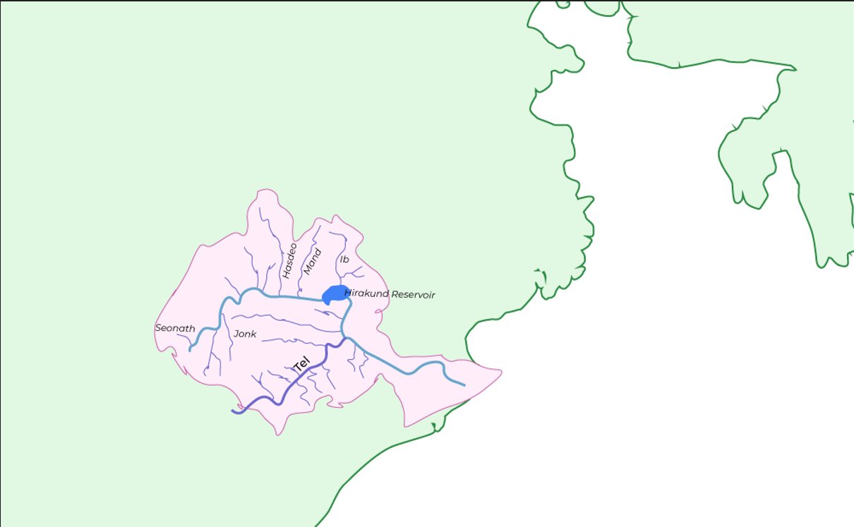
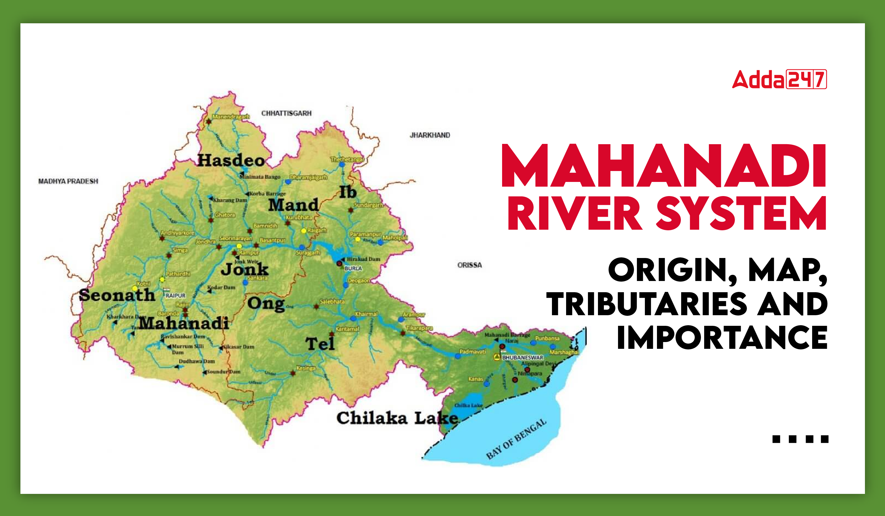
The Mahanadi river system flows mainly through the states of Chhattisgarh and Odisha, while some small parts also fall in Jharkhand, Maharashtra and Madhya Pradesh. It finally empties into the Bay of Bengal after passing through about five states. In peninsular and central India, Mahanadi is the third largest river after Godavari and Krishna. Its origin can be seen and understood by the map in the highlands of the Dandakaranya region of Chhattisgarh.

Tributaries of Mahanadi River System
Mahanadi river is considered to be the third largest river of central India after Godavari and Krishna river. The tributaries of Mahanadi are divided into two parts, the first part is called the right tributaries of Mahanadi and the second part is called the left tributaries of Mahanadi. The right tributaries of Mahanadi are Jonk, Ong and Tel while the left tributaries are Seonath, Hasdar, Mand and Ib.
| Category | Tributaries |
|---|---|
| Right Tributaries | Jonk, Ong, Tel |
| Left Tributaries | Seonath, Hasdeo, Mand, Ib |
Jonk
The Jonk River originates from the Khariyar Plateau of Odisha and flows through Chhattisgarh to join the Mahanadi River. The Jonk River flows for 182 km before joining the Mahanadi.
Ong
The Ong River originates from the Eastern Ghats and flows through the state of Odisha. It is part of the Mahanadi river system and contributes significantly to the water resources of the state.
Tel
The Tel river originates from Kalahandi district of Odisha, this river meets the Mahanadi river near Sonpur in Odisha. The total length of this river is 296 km.
Seonath
The Sevanath River originates from the Panabaras Hill at an altitude of 625 metres and flows in a north-easterly direction. It provides important water resources to the residents and industries of Durg district.
Hasdeo
Hasdeo River originates from the hills of Chhattisgarh. This river flows towards the southern part of Chhattisgarh passing through Bilaspur and Korba districts.
Mand
Mand River originates from a 686 m high hill near Surguja district and its total length is 240 km which meets Mahanadi near Chandrapur.
Ib
The Ib River originates from the hills of Raigarh district of Chhattisgarh.
Hirakud Dam
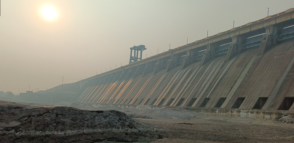
Hirakud Dam is the longest dam in India, located on the Mahanadi River. Its total length is 25.79 km, of which the main dam is 4.8 km long. The water storage capacity of this dam is 47,79,965 acre feet. Its construction began with the foundation stone laid by India’s first Prime Minister Jawaharlal Nehru on 12 April 1948 and was completed in June 1955. The main purpose of the Hirakud Dam was to end the problem of drought in the plains of Chhattisgarh and prevent agricultural destruction caused by floods in the lower delta areas. This dam has played an important role in boosting agricultural production and flood control, making it important for the economy and prosperity of the region.

Importance of Mahanadi River System for UPSC
The Mahanadi river system is an important topic for UPSC exams, especially in GS1 and GS2. Originating from the Satpura Range in Raipur district of Chhattisgarh, the river flows for about 900 km through Chhattisgarh and Odisha, with small stretches in Jharkhand, Maharashtra and Madhya Pradesh, before falling into the Bay of Bengal. The river supports agriculture, irrigation and power generation, making it important for the local economy. The right tributaries of the river are Jonk, Ong and Tel, while the left tributaries include Seonath, Hasdeo, Mand and Ib. Understanding the geographical, economic and environmental significance of the Mahanadi is essential for comprehensive UPSC preparation.


 TSPSC Group 1 Question Paper 2024, Downl...
 TSPSC Group 1 Answer key 2024 Out, Downl...
 UPSC Prelims 2024 Question Paper, Downlo...


